Global Navigation Satellite Systems, or GNSS, is a technology that exists around us like the sun. You don’t think much about it until you can no longer access it. GNSS allows you to travel to new places and find restaurants, hospitals, gyms, and markets near you. You can even track an unrecognized charge to your credit card through the timestamp, all thanks to GNSS.
So what exactly is GNSS? You probably know that several satellites in space around Earth help us use navigation systems. In simpler terms, a GPS device finds your location by picking up signals from at least four satellites. It figures out how long each signal took to arrive and uses that information to calculate exactly where you are. This process is called trilateration.
However, other systems, such as GLONASS and Galileo, contribute significantly to navigation. Let’s get to know them.
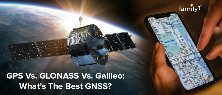
GPS, GLONASS, and Galileo – Top 3 GNSS
The three major Global Navigation Satellite Systems (GNSS) — GPS, GLONASS, and Galileo – each have unique strengths and weaknesses. Understanding these can help you select the most appropriate system(s) for specific needs or appreciate the benefits of devices that utilize multiple GNSS for enhanced performance.
GPS: The Pioneer
Global Positioning System (GPS) is perhaps the most well-known Global Navigation Satellite System (GNSS) worldwide. Developed by the United States Department of Defense, it became fully operational in 1995 and has since become a staple in global navigation and tracking technologies. GPS operates through a constellation of about 31 satellites that orbit the Earth, ensuring worldwide coverage and providing the necessary positioning services to millions of users across the globe.
Strengths
- Global Coverage: GPS offers comprehensive global coverage, ensuring users can access positioning, navigation, and timing information almost anywhere on Earth.
- High Accuracy: With the use of advanced technology and continuous improvements, GPS offers high accuracy for civilian users, typically within 5 meters. (Accuracy may vary by device and conditions)
- Widespread Adoption: GPS is integrated into a vast array of devices and systems worldwide, making it the most widely used and supported GNSS.
- Reliability: As the first system to become fully operational, GPS has a long track record of reliability and continuous availability.
Weaknesses
- Signal Obstruction: In urban canyons or areas with dense foliage, GPS signals can be obstructed, reducing accuracy.
- Dependence on US Policy: Being a US-owned system, GPS operations, and availability are subject to US government policies, which might be a concern for international users in certain scenarios.
Top 5 Uses of GPS
The versatility of GPS is one of its most remarkable features, making it indispensable in many aspects of modern life. Here are the top five uses of this first-of-its-kind system:
- Navigation and Mapping: The most common use of GPS is in navigation systems for cars, boats, and aircraft. It helps users determine their exact location, navigate from one place to another, and find the shortest or fastest routes. GPS technology is also fundamental in mapping services, enabling the creation of detailed and accurate maps of almost every place on Earth.
- Search and Rescue Operations: Worldwide search and rescue activities depend heavily on GPS. It helps emergency services respond more quickly by giving precise position data, which can save lives in dire circumstances. GPS is an essential tool in emergency response, whether it’s tracking down hikers lost in isolated locations or managing the actions of rescue personnel.
- Personal Tracking Devices: From fitness watches to child tracking devices, GPS technology has made its way into personal tracking. These devices use GPS to help individuals monitor their movements, track their fitness progress, and ensure the safety of loved ones by knowing their precise location at all times.
- Scientific Research: Among the many scientific applications of global positioning systems (GPS) are tracking animals, investigating tectonic plate movements, and keeping tabs on climate change. Researchers can learn more about our planet thanks to the precise GPS data, which aids in our comprehension of climatic shifts and animal habits.
- Agriculture: Precision agriculture is another area where GPS technology has significantly impacted. Farmers use GPS to map fields, monitor crop yields, and precisely apply fertilizers and pesticides. It not only increases efficiency and crop yields but also helps in reducing costs and environmental impact.
How GPS Impacts Personal Tracking
GPS is extremely useful for personal tracking because of its dependability and precision in open skies. Whether you’re visiting a new place, monitoring your children, or tracking your physical activity, GPS provides the information you need to make educated decisions about your movements and safety. However, it is important to note that, while GPS provides extensive coverage and high accuracy, its performance can be hampered by environmental variables like urban canyons and deep woods. Despite these problems, GPS remains an essential component of personal tracking and navigation, giving you the confidence that comes from knowing exactly where you are and how to get to your next location.
GLONASS: Russia’s Answer to GPS
GLONASS, or Global Navigation Satellite System, is Russia’s counterpart to the United States’ GPS. Officially launched in 1995, GLONASS was developed by the Russian Aerospace Defence Forces, aiming to provide an alternative global navigation system. With a full constellation of 24 satellites covering the globe, GLONASS offers similar services to GPS, ensuring that users worldwide have access to reliable positioning, navigation, and timing (PNT) information.
Strengths
- High Latitude Performance: GLONASS provides better coverage and accuracy at high latitudes (northern and southern regions), compared to GPS, due to its orbital configuration.
- Rapid Signal Acquisition: The system can acquire signals faster than GPS in certain situations, improving start-up times for navigation devices.
- Independent System: Operated by Russia, it offers an alternative to the US-operated GPS, contributing to global GNSS diversity and redundancy.
Weaknesses
- Variable Accuracy: GLONASS’s accuracy can be slightly less consistent than GPS, particularly in the equatorial region, due to the orbital position of its satellites.
- Susceptibility to Interference: The system is more susceptible to signal interference, including jamming and spoofing.
Top 5 Uses of GLONASS
GLONASS has been instrumental in various sectors, from navigation to scientific research, showcasing its versatility and importance in the global navigation satellite systems landscape. Here are the top five uses of GLONASS:
- Dual-System Navigation Devices: One of the most significant uses of GLONASS is in conjunction with GPS to enhance the accuracy and reliability of navigation devices. Many smartphones, car navigation systems, and personal tracking devices now incorporate both GLONASS and GPS, providing users with better coverage, especially in challenging environments where one system alone might not be sufficient.
- Aviation Navigation: The aviation sector uses GLONASS extensively for airport approaches and flight navigation. Its precision is essential to air travel efficiency and safety since it makes accurate landing approaches possible even in inclement weather and enhances air traffic control in general.
- Maritime Navigation: The system is also pivotal in maritime navigation, helping ships and other marine vessels determine their precise location at sea. GLONASS enhances maritime safety by supporting search and rescue operations, allowing for accurate tracking of ships in distress, and improving the efficiency of maritime transport routes.
- Military Applications: Just like GPS, GLONASS is crucial for military applications, providing accurate positioning for troop movement, navigation, and targeting. The system enhances the operational effectiveness of the military, supports strategic planning, and contributes to national security by ensuring that military assets can be precisely located and directed.
- Geodesy and Surveying: By allowing for exact measurements of the Earth’s surface, GLONASS makes a substantial contribution to geodesy and surveying. Because GLONASS, when combined with sophisticated methods, can determine locations to within a few millimeters, it is widely used by surveyors for land mapping, building design, and infrastructure development.
How GLONASS Enhances Personal Tracking?
The integration of GLONASS with other global navigation satellite systems, notably GPS, has markedly improved the performance of personal tracking devices. By accessing more satellites, devices can offer more precise and reliable location data, which is particularly beneficial in high latitudes where GLONASS satellites have better visibility. This dual-system approach ensures that whether you’re navigating through city streets, exploring remote landscapes, or tracking personal activities, you have access to the most accurate location information available.
GLONASS’s contribution to enhancing the accuracy and reliability of personal tracking and navigation devices underscores the importance of having multiple global navigation satellite systems. It not only provides a backup in case of GPS outages but also enriches the global infrastructure for navigation and tracking, ensuring that users everywhere can count on precise and dependable positioning information.
Galileo: Europe’s High Precision System
Galileo, the European Union’s flagship global navigation satellite system, represents the pinnacle of GNSS technology with a focus on precision and reliability. Officially launched in 2016, Galileo aims to provide a highly accurate, guaranteed global positioning service under civilian control. Once fully deployed, its constellation of 30 satellites will offer significant improvements in terms of accuracy and reliability over its predecessors, GPS and GLONASS, particularly in challenging environments like urban canyons.
Strengths
- High Accuracy: Galileo is designed to provide very high accuracy, up to one meter for its commercial service, which is superior to that of GPS and GLONASS for civilian use.
- Advanced Technology: Incorporating the latest in satellite navigation technology, Galileo offers features like the Search and Rescue (SAR) service, contributing to global safety efforts.
- Civilian Control: Unlike GPS and GLONASS, which have military origins, Galileo is under civilian control, ensuring its operations are geared towards civilian needs without military constraints.
- Global Coverage: Galileo is designed to provide global coverage with a focus on Europe, ensuring reliable service worldwide.
Weaknesses
- Incomplete Constellation: Although rapidly approaching full operational capability, Galileo’s constellation was not fully completed as of my last update, potentially limiting its performance and coverage in certain areas.
- Newer System: As the newest system, Galileo is still proving its reliability and integrating into global GNSS services, which might affect user adoption and device compatibility in the short term.
Each system’s unique attributes contribute to the global GNSS infrastructure, offering users a range of options for navigation and tracking. By leveraging the strengths of multiple systems simultaneously, users can achieve superior accuracy, reliability, and coverage compared to relying on a single GNSS.
Top 5 Uses of Galileo
Galileo’s advanced capabilities make it a vital asset across various sectors, enhancing efficiency, safety, and innovation. Here are the top five uses of the Galileo system:
- High-Precision Navigation for Civil Aviation: Galileo significantly contributes to the safety and efficiency of civil aviation. It offers highly accurate positioning and timing information, crucial for flight management systems, enabling more precise landing approaches, optimizing air traffic routes, and improving overall air traffic management. This precision is vital for ensuring passenger safety and reducing delays.
- Road and Automotive Navigation: In the automotive industry, Galileo enhances navigation systems by providing more accurate and reliable location data. It is particularly useful for emerging technologies like autonomous vehicles, where precision is paramount. Additionally, Galileo supports the European eCall system, an initiative aimed at bringing rapid assistance to motorists involved in a collision anywhere in the EU.
- Emergency and Search and Rescue Services: Galileo plays a critical role in search and rescue operations through its Search And Rescue (SAR) service. This feature allows to detect and locate distress signals from compatible beacons, reducing rescue times significantly. The system is designed to provide near-instantaneous signal detection and location determination, making it an invaluable tool for saving lives.
- Precision Farming: Agriculture benefits significantly from Galileo’s high-precision positioning services. Farmers may utilize Galileo to apply targeted fertilizer, plant precisely, and monitor crop health. This not only boosts production and efficiency but also helps to promote more sustainable farming methods by reducing waste and environmental effects.
- Scientific Research and Environmental Monitoring: Galileo supports a wide range of scientific research, particularly in areas requiring precise measurements and data collection, such as earth science studies, climate change monitoring, and space research. Its accurate timing and positioning services are crucial for environmental monitoring, helping scientists track changes in sea levels, ice melt rates, and atmospheric conditions with unprecedented precision.
How Galileo Enhances Personal Tracking?
Galileo’s high precision and reliability are game-changers for personal tracking applications. Its superior accuracy, especially in urban areas where GPS and GLONASS might struggle, ensures that personal navigation devices, fitness trackers, and other location-based services are more reliable and accurate than ever before. For individuals, this means improved performance in activities ranging from everyday navigation to sports and outdoor adventures.
Moreover, Galileo’s commitment to providing high-accuracy positioning services opens up new possibilities for personal safety and security applications. Devices equipped with Galileo can offer enhanced features, such as precise location sharing in emergencies, improved tracking in dense urban environments, and even the potential for indoor navigation capabilities.
The advent of Galileo marks a significant leap forward in GNSS technology, offering unparalleled precision and reliability. Its development not only signifies Europe’s independence in satellite navigation but also presents new opportunities and enhancements across a wide range of applications, including personal tracking, where the benefits of its advanced capabilities are directly felt by consumers worldwide.
Personal Tracking Challenges and the Best GNSS Solutions
Navigating through the complexities of modern life, personal tracking technologies powered by GNSS like GPS, GLONASS, and Galileo, have become indispensable. However, each tracking scenario poses unique challenges, requiring careful consideration of which system or combination thereof offers the best solution. Let’s explore five personal tracking challenges and scenarios to understand how these systems can be optimized.
1. Urban Navigation and Commuting
Challenge: Navigating the “urban canyons” of large cities with tall buildings can significantly decrease the accuracy of GNSS signals due to reflections and obstructions.
Best Solution: A combination of GPS, GLONASS, and Galileo. The integration of these systems offers a higher number of satellites, improving signal availability and accuracy in densely built-up areas. Galileo, in particular, is designed to perform well in urban environments, making it invaluable for navigating city streets and using public transport efficiently.
2. Wilderness Hiking and Adventure Sports
Challenge: Remote areas and dense foliage can obstruct signals from satellites, making it difficult to track movements accurately during hiking or adventure sports.
Best Solution: GPS and GLONASS. Both systems offer global coverage with a large constellation of satellites. The dual-system approach enhances the likelihood of maintaining a signal in challenging environments, ensuring hikers and adventurers can rely on their tracking devices for navigation and safety.
3. International Travel
Challenge: Travelers need reliable navigation information across different regions of the world, where some GNSS might offer better coverage or performance than others.
Best Solution: A multi-GNSS receiver incorporating GPS, GLONASS, and Galileo. This ensures optimal coverage and accuracy worldwide, adapting to regions where certain systems perform better. For example, GLONASS offers enhanced performance in high latitudes, particularly in northern areas, while Galileo provides high accuracy in Europe.
4. Precision Agriculture
Challenge: Farmers require highly accurate positioning to guide machinery for planting, fertilizing, and harvesting, minimizing overlaps and gaps, and ensuring efficient use of resources.
Best Solution: Galileo, combined with GPS. Galileo’s high precision is ideal for agricultural applications that demand exact positioning. When combined with GPS, it ensures a robust system capable of supporting precision agriculture technologies, enhancing productivity, and ensuring sustainability.
5. Emergency and Rescue Operations
Challenge: Quick and precise location information is crucial in search and rescue operations to efficiently deploy resources and aid those in distress, especially in remote or challenging terrains.
Best Solution: The integration of GPS, GLONASS, and Galileo, with a special emphasis on Galileo’s Search and Rescue (SAR) service. This combination ensures global coverage and the benefits of Galileo’s SAR service, which provides near-instantaneous detection and transmission of distress signals. The tri-system approach maximizes the chances of maintaining a continuous and accurate signal, which is crucial for timely and effective rescue operations.
Each of these scenarios underscores the importance of selecting the appropriate GNSS or combination thereof to meet specific challenges. While GPS offers broad coverage and good overall performance, integrating it with GLONASS and Galileo can significantly enhance accuracy, reliability, and response times across various applications and environments. This holistic approach ensures that individuals and professionals alike can navigate the world with confidence, knowing they have the best possible technological support for their personal tracking needs.
Other Noteworthy GNSS
GNSS like GPS (United States), GLONASS (Russia), and Galileo (European Union) are well known. However, there are regional and global navigation satellite systems that offer different services all over the world. Here’s a brief overview of these systems:
BeiDou Navigation Satellite System (BDS)
Country: China
Overview: Providing precise worldwide location, navigation, and timing services, BeiDou is China’s global navigation satellite system. In 2018, it completed its constellation and started providing worldwide services, competing with GPS, GLONASS, and Galileo. BeiDou stands out from the crowd because of its innovative two-way communication feature, which lets users communicate distress signals and get feedback in return.
Quasi-Zenith Satellite System (QZSS)
Country: Japan
Overview: QZSS is a regional navigation system from Japan and operates over the Asia-Oceania region. While it can work independently, it’s also compatible with and interoperable with GPS, enhancing the availability and accuracy of positioning information in populated cities and mountainous areas where GPS signals may be obstructed.
Indian Regional Navigation Satellite System (IRNSS) or Navigation with Indian Constellation (NavIC)
Country: India
Overview: India’s NavIC is a satellite navigation system that operates independently within an area. Users throughout India and the surrounding area—up to 1,500 km around its borders—can utilize its precise locating services. Disaster management, vehicle monitoring, and fleet management are just a few of the applications that NavIC hopes to bolster.
European Geostationary Navigation Overlay Service (EGNOS)
Country: European Union
Overview: EGNOS is a satellite-based augmentation system (SBAS) that improves the accuracy and reliability of GNSS signals, such as GPS and Galileo, within Europe. EGNOS is designed to support safety-critical applications like civil aviation, enhancing the performance of GNSS by providing correction signals.
Wide Area Augmentation System (WAAS)
Country: United States
Overview: Similar to EGNOS, WAAS is an SBAS that enhances the accuracy, availability, and reliability of GPS signals for users in North America, particularly for aviation purposes. It corrects GPS signal errors caused by ionospheric disturbances, timing, and satellite orbit errors, and provides better positioning accuracy.
These systems enhance both global and regional navigation capabilities by complementing the current GNSS infrastructure, regardless of whether they operate worldwide or concentrate on particular regions. They guarantee more accurate and dependable positioning, navigation, and timing (PNT) services for a variety of global military, commercial, and civilian applications.
Why Do We Need Multiple GNSS?
At first look, the fact that there are many guidance systems in the world, such as GPS, GLONASS, Galileo, BeiDou, and regional systems like NavIC and QZSS, may seem like a big deal. There are, however, reasons for creating and maintaining these different systems, and they all work together to make global tracking stronger, more reliable, and more accurate. Here’s why having multiple navigation systems is beneficial:
Redundancy and reliability
Multiple systems provide redundancy, which is essential for reliability. If one system experiences technical difficulties, becomes partially blocked by natural or human-made impediments, or is intentionally tampered with, others can fill the void, maintaining uninterrupted service.
Increased accuracy and coverage
Different systems have varying strengths in terms of coverage and accuracy, especially in challenging environments like urban canyons or polar regions. By leveraging multiple systems, users can achieve better accuracy and more consistent coverage globally, enhancing the performance of navigation and tracking applications.
Sovereignty and security
Navigation systems are strategic assets. Having an independent system ensures national sovereignty and security, reducing reliance on foreign systems that might be restricted or turned off during geopolitical tensions. It is particularly important for military and critical infrastructure applications.
Specialized Regional Services
Regional systems like NavIC and QZSS are designed to complement global systems by providing enhanced services tailored to specific geographic areas. These systems offer improved accuracy, integrity, and availability in their targeted regions, supporting local economies and public safety needs.
Innovation and Economic Development
The development of indigenous navigation systems fosters technological innovation builds expertise in satellite and aerospace technologies, and stimulates economic development. It encourages the growth of related industries, including electronics, telecommunications, and software, creating jobs and business opportunities.
Support for a Wide Range of Applications
Having multiple GNSS options enables support for a wide range of applications, from everyday navigation and personal tracking to precision farming, disaster response, and scientific research. Different systems may offer unique features, such as Beidou’s short messaging service, enhancing their utility for specific uses.
International Collaboration
The existence of multiple systems encourages international collaboration as countries work together to ensure interoperability and compatibility between systems. This cooperation benefits users worldwide by providing more robust and versatile navigation services.
What Would Happen If The GNSS Shut Down?
Worldwide and significantly impacting many industries and daily operations, a complete shutdown of all GNSS would be an enormous and unexpected event. The Global Navigation Satellite System (GNSS) encompasses systems such as GPS in the US, GLONASS in Russia, Galileo in the EU, and BeiDou in China. These are the possible outcomes:
- Navigation and Transportation: The most immediate and obvious impact would be on navigation and transportation. Aircraft, ships, and vehicles rely on GNSS for navigation and routing. A shutdown would disrupt airline operations, maritime navigation, and land transportation, potentially leading to increased accidents, delays, and inefficiencies.
- Telecommunications: The synchronization of data flows in cellular networks and other telecommunications networks relies on the exact time signals provided by GNSS. Communication services, such as internet and mobile phone access, might be disrupted in the event of a shutdown that affects these networks.
- Emergency Services: Emergency response services, such as ambulance, fire, and police, rely on GNSS for location monitoring and dispatching. A loss of GNSS capabilities might cause delays in response times and impede rescue efforts
- Financial Services: GNSS provides accurate timing that allows the financial sector to time stamp deals and coordinate global financial swaps. A problem could make it hard to trade and do business with money, which could make the market unstable.
- Agriculture: Modern agriculture uses GNSS for precision farming techniques, such as guiding tractors, monitoring crop health, and managing resources. A shutdown could result in decreased efficiency, higher costs, and reduced crop yields.
- Science and Environment Monitoring: Tracking weather trends, keeping an eye on earthquakes, and studying climate change are all things that GNSS helps with science research and environmental monitoring. Losing GNSS data could make these efforts harder, which could hurt environmental protection and crisis preparation.
- Public Services and Utilities: When it comes to timing and synchronization, GNSS is indispensable for many public services and utilities. It includes water supply systems and electricity grids. These important services may not be delivered as planned if disruptions occur.
Conclusion
The overall robustness, precision, and utility of global navigation and positioning services are all improved as a result of the diversity of global and regional navigation satellite systems. Because it reflects a deliberate approach to ensuring that navigation and timing services continue to be available to a large number of people and stay uninterrupted, it can serve a wide variety of applications that are essential to the contemporary economy and society.